Q&A: How scientists tackle the challenges of estimating wildfire CO2 emissions
Giuliana Viglione
09.22.23Giuliana Viglione
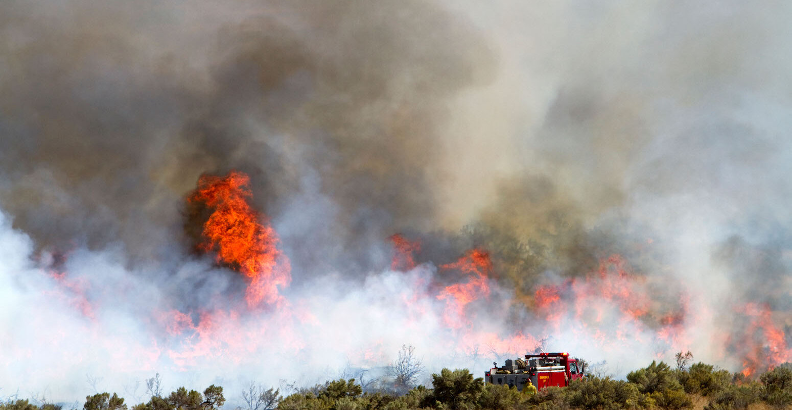
22.09.2023 | 2:48pmWildfires – and their emissions – have made headlines around the world this year.
From the otherworldly haze that blanketed much of the US east coast in June to the devastating fire that ripped through Hawaii’s Maui in early August, the impacts of fire are becoming increasingly tangible beyond typically fire-prone regions.
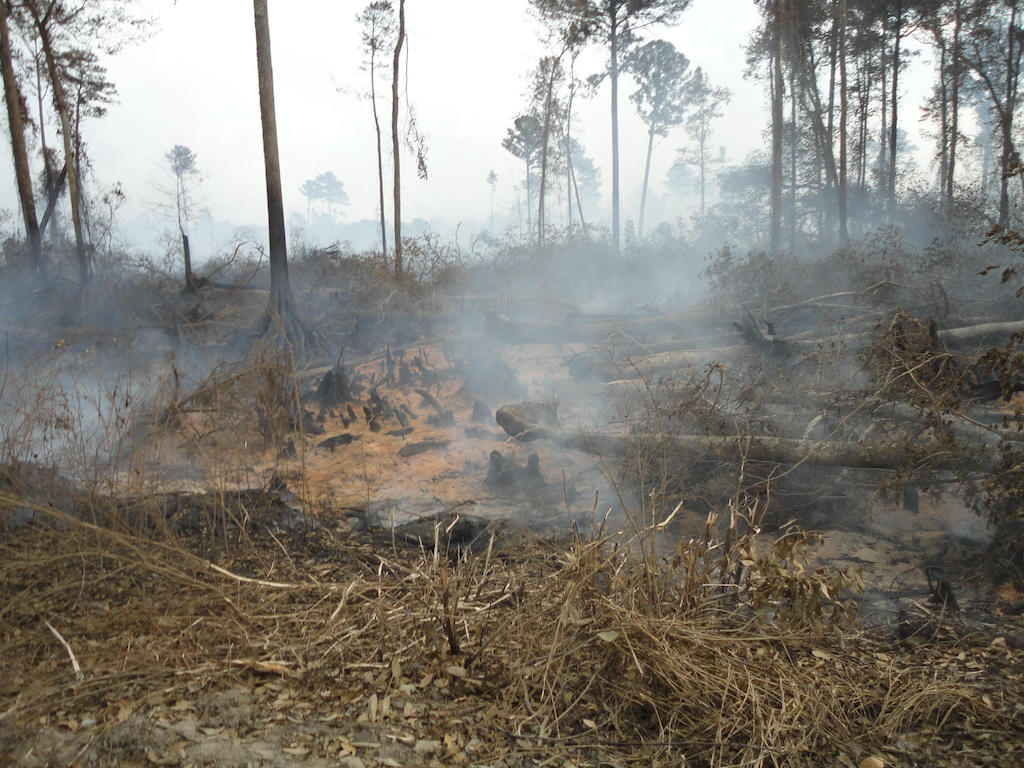
Wildfires are fuelled, in part, by climate change. But they also change the climate, emitting around 5.3bn tonnes of CO2 to the atmosphere in 2022 – more than any country contributed from fossil-fuel burning that year, except China.
Measuring and modelling these emissions are becoming increasingly important, but scientists attempting to do so face many challenges.
Last week, researchers from around the world gathered online and in person at the National Academies in Washington DC for a workshop addressing the challenges and opportunities in measuring, modelling and managing greenhouse gas emissions from wildland fires.
Carbon Brief attended the conference and captured the key points and challenges discussed by researchers and foresters over the three-day workshop.
- What role does fire play in different ecosystems?
- What are the challenges in measuring emissions from wildland fires?
- What are the challenges in modelling emissions from wildland fires?
- What is the connection between wildfires and net-zero targets?
- How can fires be managed in the future?
What role does fire play in different ecosystems?
Wildland fires affect broad swathes of the Earth, from the tropical regions to the Arctic.
The term “wildland fires” describes any fire that originates outside of the built environment, whether planned or unplanned – including prescribed burns, cultural burning and wildfires.
In each of these places, human activities are affecting the ways that fire interacts with the landscape, either directly or indirectly. The dominant factor depends on the type of ecosystem.
In the opening session, Dr Nancy French, a senior research scientist at Michigan Technological University, outlined how fire is changing across three broad ecosystems.
In the Arctic region and boreal forests – the northernmost forest ecosystem in the world – changes in fire are primarily due to climate change, she said. In tropical regions, changes are almost exclusively due to land and fire management. For temperate forests, a combination of climate change and land management are driving changes in fire.
Regions also differ in the main immediate drivers of fire, several speakers noted. In tropical peatlands, wildland fires are almost entirely due to human ignition sources, while in the boreal regions, more than 90% of ignitions come from lightning strikes.
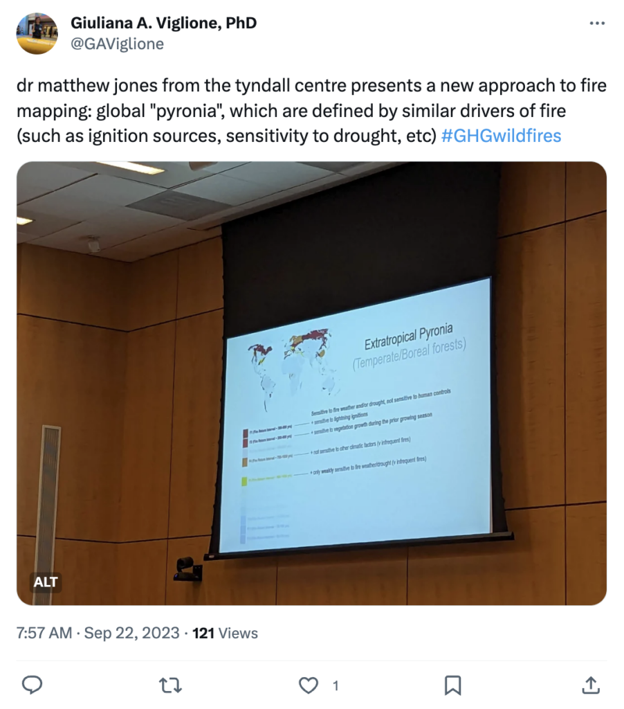
Later in the workshop, Dr Matthew Jones, a researcher at the Tyndall Centre for Climate Change Research, presented a more spatially explicit view of global fire patterns.
Building on work that has mapped global “pyromes” – areas of the world with similar fire characteristics – Jones showed maps of “pyronia”, areas defined by similar, distinct controls on fire. These pyronia were grouped by meteorological, vegetation and human factors.
Fire is an “integral force in the Earth system and a vital tool for land stewardship”, French said. She also pointed out that fire affects the climate system over a range of timescales.
In the short term, fires emit greenhouse gases directly into the atmosphere. But in the period following a fire, emissions can continue to increase, as dead trees decompose, she noted. And the landscape’s ability to take up carbon is lowered due to the reduction in vegetation.
Prof Matthew Hurteau, a forest ecologist at the University of New Mexico, stressed the need to study changes in forest carbon on large scales. He told the room:
“We really need to be investigating these carbon questions at the appropriate temporal and spatial scales when we’re thinking about wildfire.”
Several presenters questioned the common approach of focusing on “area burned” as the sole metric by which wildfire is measured.
Dr Amy Cardinal Christianson, a fire research scientist with the Canadian Forest Service, emphasised the importance of considering fire’s impacts on humans, not just the climate.
Christianson presented data on the number of evacuations due to wildfires in Canada, pointing out that evacuations – due to either direct fire danger or dangerous air quality from smoke – disproportionately affect Indigenous communities. Although Indigenous peoples only make up around 5% of the Canadian population, she said, more than 40% of evacuations since 1980 have occurred in majority Indigenous communities.
Other researchers highlighted deaths, costs and damages as measures by which wildfire impacts could be evaluated.
What are the challenges in measuring emissions from wildland fires?
The second day of the workshop focused on the closely related challenges of measuring and modelling emissions from wildfires.
Monitoring wildfires is a problem of scale, participants heard. It is simply not feasible to have on-the-ground observations of every wildland fire.
As such, satellites remain the “only practical way to comprehensively observe” these fires, said Dr Louis Giglio, a research professor at the University of Maryland. But the satellite record is “extremely short” compared to the timescales of human history and climate, he added.
Remote sensing is not infallible, either. Satellites can determine “false fires” from sun glint or areas of high reflectance, while cloud shadows can be misinterpreted as “false burns”.
And satellites cannot reliably identify fires below a certain size, leading to uncertainty in estimates of fire extent, especially in places where fires are small, but numerous. As Giglio asked the room: “Is burned area declining in Africa, or are the burns becoming more patchy?”
Where ground-based data does exist, it is collected by a range of different government bodies and private parties, and is not always easily accessible, several workshop participants noted. This makes calibrating and validating emissions models difficult.
For the most part, scientists “have a good handle” on where fires are occurring, said Dr Andrew Hudak, a research forester with the US Forest Service.
But understanding the emissions associated with these fires is more complex, requiring knowledge of the vegetation type, the strength of the fire and the landscape. For example, fires that smoulder, rather than flame, contribute disproportionately to emissions.
To measure emissions from a given fire, scientists can take a top-down or a bottom-up approach, Hudak explained.
Top-down approaches involve using satellite measurements and atmospheric transport models to estimate the amount of CO2 associated with a particular burn. Bottom-up approaches use either direct measures of the heat given off by a fire or estimates of the pre- and post-fire fuel load in a forest to determine fire emissions.
Dr Morgan Varner, the director of fire research at Tall Timbers, a land conservancy and fire-research centre based in Florida, named the “big three uncertainties” associated with measuring emissions from wildfires: fuel distribution, fire behaviour and fuel consumption.
These challenges are “complex, but not insurmountable”, Varner added.
In subsequent discussions, participants discussed priorities for improved data collection, including field data on fuel loads, appropriate land-cover and fuel maps and improving the use of existing data.
What are the challenges in modelling emissions from wildland fires?
Participants were divided as to the usefulness of current wildfire models. There is a wide variety of models, from small-scale regional models to global ones. Models can rely on either statistical relationships or dynamics to predict fire behaviour.
Over the past decade, an international research initiative called the Fire Modeling Intercomparison Project (FireMIP) has attempted to systematically compare global fire models and provide a standardised set of models for the wildfire community to use.
Most global fire models broadly reproduce the distribution of burned area, pointed out Dr Stijn Hantson, an associate professor at the Universidad del Rosario in Colombia. Hantson showed results from FireMIP, which he said “broadly represent” global fire activity correctly.
Prof Jed Kaplan, from the University of Calgary, was more blunt in his assessment:
“I don’t think that the global fire models are good at all.”
Kaplan pointed out that there is a “wild range” in estimates of emissions for both past and future from current fire models, largely tied to differences in the representation of the weather. Although the patterns may be similar, the magnitude of burning diverges between models. And land management – a critical factor in the development of future fires – is missing from current models, Kaplan added.
Hantson agreed that it is important that models represent large-scale patterns “for the right reasons”. As part of this, he said, fire models must be coupled to vegetation models, which include variables such as soil properties, photosynthesis, respiration and soil carbon. These can essentially act as dynamical fuel models when coupled to fire models, Hantson said.
Accurately modelling fires at a larger scale, said Dr Park Williams, a hydroclimatologist at the University of California, Los Angeles, would likely require large-scale investment, similar to the resources devoted to global climate models.
One ongoing challenge to fire modelling, the researchers agreed, was uncertainty around how global vegetation will respond to increasing atmospheric CO2 – that is, the strength of the “CO2 fertilisation” effect.
Fire models also do not account for pests and pathogens, which are projected to become increasingly common in much of the world under continued warming.
While global fire models require further refinement, the researchers agreed that landscape modelling has already proven useful as an effective tool for guiding management decisions.
What is the connection between wildfires and net-zero targets?
Wildfires are the main driver of year-to-year variability in the world’s greenhouse gas emissions, said Dr Grant Domke, a research forester with the US Forest Service.
And yet, the lack of accurate measurements of today’s wildfire emissions is likely to hinder efforts to manage them in the future, said Dr Bo Zheng, an associate professor at Tsinghua University. After all, he added, “we can’t cut what we don’t count”.
Emissions from wildland fires are considered natural and, therefore, are not included in national greenhouse gas inventories. This is despite the fact that human activities are in many cases directly responsible for such fires, several speakers pointed out.
Prof David Bowman, a fire scientist from the University of Tasmania, explained that the Australian wildfires of the “black summer” of 2019-20 have been estimated at 1.6 times the country’s national emissions from that year.
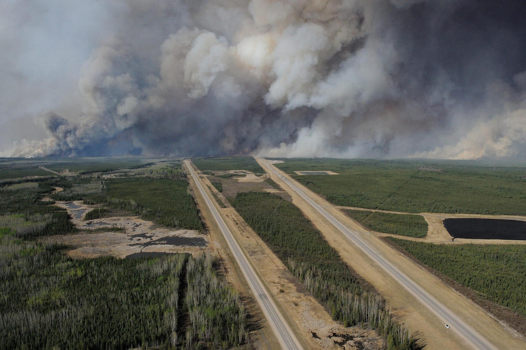
And Canada, which is in the midst of its worst fire season on record, has already seen wildfire emissions more than three times higher than in the previous worst year of 2021, said Dr Werner Kurz, a senior research scientist with the Canadian Forest Service.
However, CO2 emissions are not the primary consideration in how fires are managed, pointed out Dr Peter Frumhoff, a global-change ecologist and the senior science policy advisor at the Woodwell Climate Research Center. Most stakeholders are more concerned with human safety, property damage or air quality, he added.
Policymakers need to “be realistic about the potential of the land sector” in climate mitigation, Domke said, pointing out that many net-zero strategies rely on planting trees to take up carbon from the atmosphere.
Attendees heard from researchers working around the world about changes in the functioning of a range of ecosystems.
Humans are changing the boreal forest “dramatically”, said Prof Scott Stephens, a professor of fire science at the University of California, Berkeley. Historically, the Canadian boreal forest had high-severity fires every 40-150 years. But fires are beginning to burn at intervals not seen before, with major implications for the carbon stocks contained within those forests.
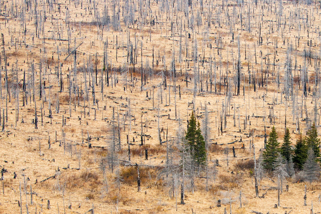
Dr Hélène Genet, a terrestrial ecologist from the University of Alaska Fairbanks, noted that during a particularly severe wildfire year in Alaska, an estimated 10 years’s worth of accumulated carbon was lost from the ecosystem. Increased fire severity could potentially lead to abrupt thaw and the permanent loss of permafrost, she added.
In California’s Sierra Nevada, which naturally experiences frequent fires, the combination of warming and earlier snowmelt is leading to increased fire, Hurteau said.
And, in Brazil, said Dr Marcia Macedo from the Woodwell Climate Research Center, humans are changing all three of the main drivers of fire: ignition sources, fuel and climate. “Stopping deforestation is priority number one,” she added. She noted that research published in Nature in 2021 has shown that some parts of the Amazon are already switching from being a carbon sink to a carbon source.
How can fires be managed in the future?
More than a century of colonial fire management and suppression has resulted in a “loss of cadence” in many wildland ecosystems, French told the room. In other words, the lack of regular fires in these ecosystems has disrupted natural cycles. But there is evidence that some of these losses can be reversed.
In California’s Yosemite National Park, for example, fires were actively suppressed as part of government policy for nearly 100 years. But since 1974, lightning-ignited fires have been allowed to burn in the park, Stephens said. For nearly five decades, these fires have been “self-regulating”, he added – meaning that they burn out on their own and areas do not re-burn as frequently. As a result, increases in fire severity are not being observed in Yosemite as they are elsewhere in the western US, Stephens said.
In the tropics, where fire is often used as a cheap method of land-clearing for both large-scale plantation agriculture and smallholder and subsistence farmers, effective management must involve providing economic alternatives to those who rely on the land, said Prof Susan Page, a professor at the University of Leicester.
Reducing fire risk in tropical peatlands is not just about landscape recovery, but also about helping people to live with more flammable landscapes, Page said.
The use of prescribed or cultural burning as a management tool was raised several times throughout the workshop, especially in the context of temperate forests. Prescribed burns are controlled burns that are intentionally lit to reduce fuel loads or restore ecosystem health. The strategy of cultural burning, which also relies on smaller, controlled burns, has been used by Indigenous peoples for thousands of years.
Changing public perception around prescribed burns would be critical to its acceptance as a strategy, participants agreed.
And prescribed burns are still burns – and thus, come with a carbon cost in the short term. As Hurteau put it:
“When you cut down trees and light the place on fire, you’re going to put some smoke in the atmosphere.”
In fact, Varner pointed out, in seven out of every 10 years, the area burned in the US for prescribed burns is larger than the area burned by wildfires.
Participants focused on “mosaics” as a method of limiting the spread of and damages due to fire. Fire mosaics are landscapes comprising a mix of land cover and land uses. Mosaics were traditionally created by Indigenous peoples, and have been shown to be less fire-prone than forest alone.
Many of the conference attendees spoke of the need to learn from Indigenous partners, who have been stewards of the land for millennia. Christianson, who is a Métis woman from Treaty 8 territory in western Canada, took that one step further. She told the assembled participants:
“We need indigenous leadership here. And so instead of agencies always wanting to learn from us or learn our ways, [we need them] knowing when it’s time to step out of the way and let us manage our own territories for fire.”
-
Q&A: How scientists tackle the challenges of estimating wildfire CO2 emissions